


listerCompass app for iPhone and iPad
Developer: The Virtual Explorer Pty Ltd
First release : 14 Jun 2012
App size: 6.68 Mb
A stereographic compass for use by a structural geologist in the field.
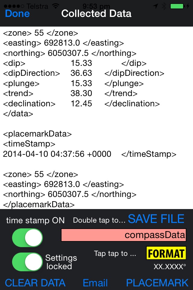
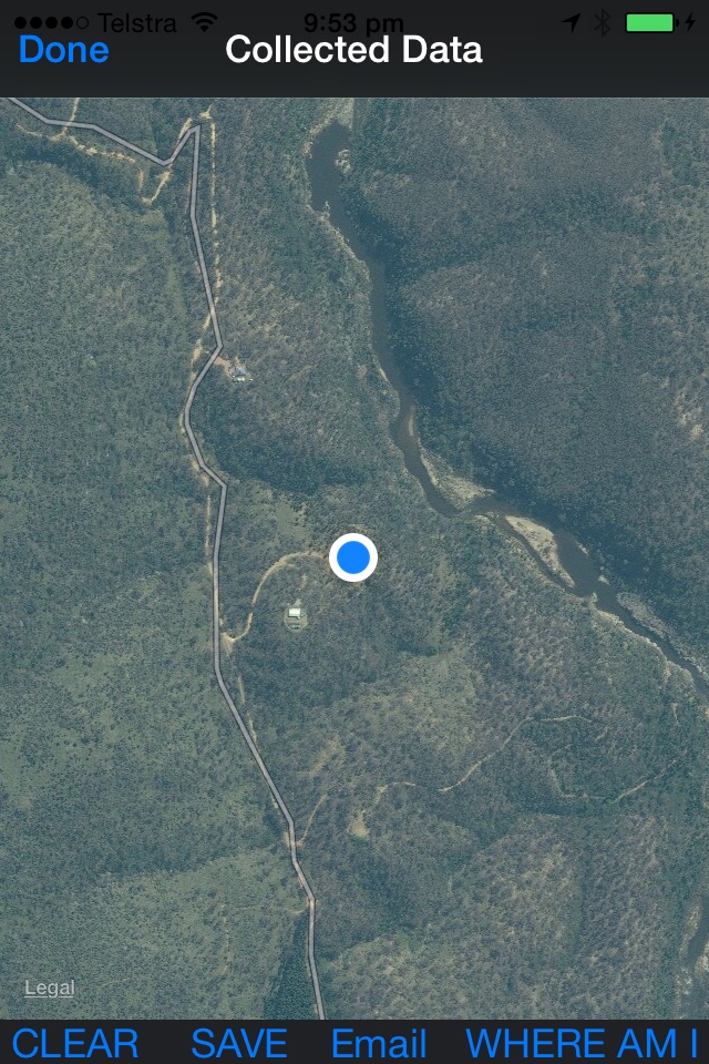
The compass readily allows measurement of foliations and lineations, records the information, and allows placemark pins to be dropped on a map to record traverse information. It is designed by a professional structural geologist, and takes into account practical issues: i) measuring upside down under overhangs; ii) measures lineations separately, or foliations, or all together (tap tap on the display to change); iii) allows on the fly data descriptions to be logged; iv) allows export of data, including a KML file that can be dragged onto GoogleEarth to record placemark locations.
Records data in a variety of different formats: i) UTM; ii) latitude-longitude. Double tap on the display screen to change. Toggle between the compass screen, the data display, and the map. Autosaves your data and allows export via email, or using iTunes.
Use different formats: i) strike, dip and rake if you focus on planes, and lines on planes; ii) yaw, pitch and roll if you focus on the lines themselves; or iii) standard data formats such as dip->dipDirection and plunge->trend to emulate BREITHAUPT COMPASS, or strikeQuadrantDip (e.g., 200NW30) to emulate BRUNTON COMPASS. Annotate place mark pins, or record info in the data log.
The listerCompass also provides options for statistical analysis.